Nuʻuanu Pali Lookout On Oʻahu: Access, Timing And Whether It Is Worth The Trip
The Nuʻuanu Pali Lookout is one of Oʻahu's most dramatic viewpoints, a cliff-edge platform above the windward coast, and as of September 2026 it is closed for storm repairs. Here is what a visit involves when it reopens, and how to plan around the closure.
Short answer
The Nuʻuanu Pali Lookout is a state wayside perched on the Koʻolau cliffs above Kāneʻohe, famous for its windward panorama and near-constant trade winds. It is currently closed until further notice following storm damage, so check the DLNR State Parks notices before planning a visit.
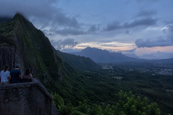
The Nuʻuanu Pali Lookout sits at the top of the Pali Highway, where the Koʻolau mountain range tears open and the island drops away toward Kāneʻohe Bay. On a clear day the platform delivers one of the widest panoramas on Oʻahu: the windward coast, the bay, Mokoliʻi off in the distance, and the ridgelines of the Koʻolau running north. It is also, as of the DLNR State Parks notice dated 9 September 2026, closed until further notice while storm damage from Hurricane Lowell is repaired.
That closure is the first thing any honest guide has to say, because a lot of content online still describes the lookout as a quick roadside stop you can slot between Waikīkī and Kailua. This page covers what the lookout actually is, how to check its status, how the visit works when it is open, and how to weigh it against the rest of your itinerary. For the wider picture of the island's highlights, start with our things to do in Oahu roundup, or read on for the Pali specifically.
What Is The Nuʻuanu Pali Lookout?
The Nuʻuanu Pali Lookout is a small state wayside on the cliff edge of the Nuʻuanu Pali, the gap in the Koʻolau range where the Pali Highway crosses from Honolulu's side of the island to the windward coast. It consists of a paved viewing platform, railings and a parking area, and it looks out over Kāneʻohe, Kāneʻohe Bay and the windward shoreline.
The name translates plainly: pali means cliff, and Nuʻuanu is the valley the highway climbs through.
"Pali" shows up all over Hawaiian place names because cliffs define this island's geography. The Koʻolau range is the eroded remnant of a massive volcano, and its windward face is a wall of razorback ridges that the trade winds push clouds against all day. Nuʻuanu is one of the few gaps where a road threads through, which is exactly why a lookout exists here at all: the highway has to climb to roughly the level of the saddle, and the viewpoint sits where the terrain opened up.
The lookout's reputation rests on two things. One is the view, which on a clear morning takes in an enormous stretch of windward Oʻahu. The other is the wind. The Pali funnels the trade winds through the gap, and on a typical day the platform is gusty enough to make hats airborne and to pin loose clothing flat. Visitors describe leaning into it, and that experience, the sensation of standing in a wind tunnel with the island laid out below, is what most people remember.
It is a stop, not a destination. There is no trail from the lookout, no visitor centre and no facilities beyond the basics. You park, walk to the rail, take in the view, take your photos and move on. Fifteen to thirty minutes covers it comfortably. The question is therefore not whether the lookout fills a day, but whether the detour is worth the drive, and that depends heavily on where the rest of your day is pointed.
Is The Nuʻuanu Pali Lookout Open Right Now?
No. As of the DLNR State Parks notice dated 9 September 2026, Nuʻuanu Pali State Wayside is closed until further notice for storm repairs following Hurricane Lowell. Kaʻena Point State Park's Mokuleʻia and Keawaʻula sections and Wahiawā Freshwater State Recreation Area are also closed on Oʻahu. There is no published reopening date, so any itinerary that includes the Pali needs a backup stop and a status check the week you travel.
The closure is part of a wider DLNR storm-repair effort across the state parks system, and the notices banner at dlnr.hawaii.gov/dsp/ is the authoritative source. This is a moving situation: the notice we verified was read on 10 September 2026, and these closures have been changing as repairs progress. Do not rely on a travel forum post or a cached article, including this one, as your final check. Look at the DLNR page the week you fly.
| Item | Status | Source |
|---|---|---|
| Nuʻuanu Pali State Wayside | Closed until further notice, storm repairs | DLNR State Parks notice, 9 Sept 2026 |
| Kaʻena Point State Park (Mokuleʻia and Keawaʻula sections) | Closed until further notice | Same DLNR notice |
| Wahiawā Freshwater State Recreation Area | Closed until further notice | Same DLNR notice |
| Storm-related reservation refunds | Automatic, minus non-refundable service charges, 4 to 6 weeks | DLNR notice |
If the Pali is closed during your trip, the practical substitute is to take in the windward scenery another way. The drive down the Pali Highway toward Kāneʻohe still delivers the same dramatic transition from leeward city to windward green, and the Kāneʻohe and windward coast guide covers the stops that are actually open. A guided option also solves the problem neatly: the seven-lookouts half-day tour below routes through Oʻahu's best viewpoints, and its operator will know the current state of each stop.
How Do You Get To The Nuʻuanu Pali Lookout?
The lookout sits on the Pali Highway between Honolulu and Kāneʻohe, a few minutes past the summit on the windward side. When open, it is reached by car, tour vehicle or a bus connection from downtown Honolulu, and it is a common stop on circle-island and scenic driving routes. There is no rail connection: the Skyline serves the airport corridor and has no Waikīkī station, so most visitors arrive by road.
Driving it yourself is the flexible option. The Pali Highway runs from downtown Honolulu through Nuʻuanu valley and over the saddle to Kāneʻohe, and the lookout parking area is signed on the windward descent. The road is a divided highway through the valley section, and the final climb is a series of curves through the gap. Weather on the windward side is a different world from Waikīkī, which matters for both the drive and the view, and we cover that below.
To make the windward crossing on your own schedule, book a rental car here.
If you are not driving, transit is workable but slower. TheBus and Skyline share a fare structure: $3.25 for an adult cash single ride on TheBus with no transfers, a $3.00 HOLO two-hour pass with transfers, and a $7.50 daily cap on a HOLO card, after which the rest of the day's rides are free. A 3-day pass is $20.00 and a 7-day pass $45.00. The card itself costs $2.00.
| Fare | Price | Notes |
|---|---|---|
| Adult cash, TheBus single ride | $3.25 | Exact fare, no transfers |
| HOLO 2-hour pass | $3.00 | Unlimited transfers, TheBus and Skyline |
| Daily cap | $7.50 | Max charged per day, then free |
| 3-day pass | $20.00 | 72 hours from first tap |
| 7-day pass | $45.00 | 168 hours from first tap |
| Monthly cap | $90.00 | Month cap on HOLO |
The trade-off with transit is that the lookout is a roadside stop on a highway, and connections from the nearest bus corridors add real time to the day. Many visitors without a car instead book a scenic tour that includes the Pali among its stops, which converts the access problem into someone else's job. Our do you need a car on Oʻahu guide breaks down that decision in full, including where transit works well and where it does not.
What Does A Visit To The Pali Actually Involve?
A visit, when the lookout is open, is short and simple: you park in the wayside lot, walk a paved path to the railed platform, and take in the windward panorama of Kāneʻohe, Kāneʻohe Bay and the coast beyond. There is no hike, no ticketed entry and no interpretive centre. The wind is the constant, strong enough most days that loose items need securing, and most visits run fifteen to thirty minutes.
The platform faces northeast, which shapes the photography. Morning light comes from behind you over the ocean and lights the windward coast evenly, and mornings are also when the view is most likely to be clear. By afternoon the trade winds have spent hours pushing clouds against the Koʻolau, and the ridges can be socked in with cloud even while Waikīkī, on the leeward side, stays sunny. This is the single most common disappointment at the Pali: people drive up from a sunny beach and find the platform in fog. Everything else covered here is indexed on Oahu Travel Guide.
Dress for the wind rather than for the beach. The temperature drop from sea level to the saddle is real but modest; the wind chill is not modest, and visitors in swimwear and slippers regularly regret it. A light layer and secured headwear make the difference between a quick photo and an actual look at the view.
The other thing to know is that the lookout is a place with deep significance in Hawaiian history, and the site deserves more than a drive-by selfie. The pali was the setting of one of the pivotal battles in the islands' history, fought as Kamehameha I's forces pushed across Oʻahu, and the cliffs here carry that weight for many kamaʻāina. Nothing at the platform requires solemnity, but the site is not just a pretty backdrop either. Treat it the way you would any place where something consequential happened.
If the wind and the weather cooperate, the stop is genuinely memorable, and it pairs naturally with the windward coast: Kāneʻohe, Kailua and the beaches beyond are all downhill from the Pali. A common route is lookout, then windward coast, then back over the island by one of the other highway crossings. If you would rather not plan that yourself, a scenic tour that includes the Pali handles the sequencing and the parking.
When Is The Best Time To Visit The Nuʻuanu Pali Lookout?
Morning is the best time, and the reason is the rain. The Koʻolau's windward face is one of the wettest places near Honolulu, and clouds build against the ridges through the day, so the view is most often clear early. The trade winds blow year-round, so wind is not a seasonal factor, but the cloud cover absolutely is. Visit before about 10 a.m. and your odds of a clear panorama are far better.
The numbers behind this are striking, and they are one of the least-understood facts about Oʻahu's geography. Official 1991-2020 climate normals show Honolulu's airport, on the leeward coast, receives 16.41 inches of rain per year. The Lyon Arboretum station in Mānoa, a valley about five miles inland, receives 150.96 inches, more than nine times as much, and every single month at Mānoa is wetter than the airport's wettest month. Kāneʻohe Bay on the windward coast, which the Pali looks down on, records 27.82 inches annually, with November the wettest at 3.68 inches.
| Station | Side of island | Annual rainfall | Character |
|---|---|---|---|
| Honolulu International Airport | Leeward coast | 16.41 in | Driest; June lowest at 0.50 in |
| Kāneʻohe Bay MCAS | Windward coast | 27.82 in | November wettest at 3.68 in |
| Mānoa, Lyon Arboretum | Windward valley, ~5 mi from Waikīkī | 150.96 in | Every month wetter than the airport's wettest |
What this means for the Pali is that the lookout sits on the boundary between two climates. Waikīkī, a few miles south, is in the dry zone. The valley you look down into is among the wettest terrain in the state. The clouds you watch pour over the ridgeline are the visible engine of that difference, and the same dynamics that make the view dramatic also make it unreliable in the afternoon.
Seasonally, there is no bad month for the Pali in principle; the trade winds blow most of the year and the view exists in every season. But winter brings both more rain on the windward side and, historically, the storm systems that periodically damage the park infrastructure, which is the current situation. If your trip falls in hurricane season, roughly June through November, keep a weather eye on the forecast and on DLNR notices generally, not just for this site.
What Can You See From The Nuʻuanu Pali Lookout?
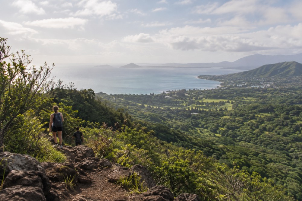
From the platform you look northeast over the windward plain: Kāneʻohe and its residential ridges, the long sweep of Kāneʻohe Bay with its patch reef, the Kailua side of the coast beyond, and on clear days Mokoliʻi, the small island off Kualoa, visible far to the north. The foreground is the valley the highway descends into, and the Koʻolau's ridgeline frames it all.
Kāneʻohe Bay dominates the middle distance. It is a large embayment fringed by reefs, and from the lookout the water reads as a mosaic of blues and greens depending on depth and reef. The town of Kāneʻohe climbs the lower slopes to the south, and the Kailua side stretches off to the right, toward the beaches covered in our Kailua guide.
Mokoliʻi, the small basalt island off Kualoa, is the classic far marker in photographs from the Pali. On a very clear day it sits on the horizon like a punctuation mark at the end of the coastal plain. It is a good test of conditions: if you can pick out Mokoliʻi, the view is having one of its best days.
Two practical notes for photographers. First, the railing constrains foreground composition, so a phone held above it or a lens through it is the usual approach. Second, the wind matters for more than comfort: long exposures and lightweight tripods struggle in the gusts, and drone photography is prohibited in Hawaii state parks without a written permit, so the airborne shot is not an option here. The golden-hour window is short everywhere on Oʻahu, because the island's sunset never runs later than about 7:17 p.m. even in midsummer; our photography spots and golden hour guide covers where to be instead when the light turns.
Is The Nuʻuanu Pali Lookout Worth The Trip?
For most visitors, yes, when it is open, because it is the single best place to see the Koʻolau's windward face and the Kāneʻohe coast in one view, and the drive to it is half the experience. The honest qualifiers are three: it is currently closed, it is a short stop rather than a half-day destination, and the afternoon clouds can erase the view entirely. Plan it as a morning stop on a windward-coast day.
Compare it honestly against the alternatives. Tantalus Lookout above Honolulu gives you a city-and-ocean panorama without leaving the leeward side, and our Tantalus Lookout guide covers it. Lēʻahi, the crater signposted as Diamond Head, gives you the classic seaward view plus a real hike, but it requires an out-of-state reservation, entry is $5 per person plus $10 per vehicle, and cards only. The Pali, when open, asks nothing but the drive and gives you the island's most dramatic inland geography. They are different products, and a full itinerary can hold both.
The strongest case for the Pali is as part of a windward day. Lookout in the morning, Kāneʻohe or Kailua through the middle of the day, and back over the island by the Likelike or H-3 crossing in the afternoon, is a loop that shows you more of Oʻahu's range than any single beach day. The H-3 in particular runs through a different gap in the Koʻolau, and the transition is its own attraction.
If you are short on days or would rather not drive the crossings yourself, the guided route is reasonable. A half-day scenic tour that strings together multiple lookouts delivers the Pali's kind of view, with a driver handling the highway, and the two tours below cover the other experiences most often paired with it: the Diamond Head hike with the ticket and transport sorted, and the self-guided Mānoa Falls rainforest walk on the valley side of the same mountain weather.
The Diamond Head option solves that park's own planning problem, since non-resident reservations are mandatory and the tour arrives with entry already arranged. The rainforest walk below is its quieter counterpart, a self-guided descent into the same wet valley climate you were just looking down on from the rail.
Between the three, most visitors can assemble a windward-and-valley day without ever planning a highway crossing of their own, and the comparison below puts the full set side by side.
Common Questions About The Nuʻuanu Pali Lookout
Most questions about the Pali come down to three things: whether it is open, how to get there, and whether the weather will cooperate. It is currently closed for storm repairs with no reopening date, it sits on the Pali Highway a short drive from downtown Honolulu, and the windward clouds build through the day, which makes morning the reliable window. Everything else, from what to wear to how long to stay, follows from those three answers.
Is the Nuʻuanu Pali Lookout open?
Not at present. The DLNR State Parks notice dated 9 September 2026 lists Nuʻuanu Pali State Wayside as closed until further notice for storm repairs following Hurricane Lowell. Check the DLNR notices page the week you travel, because these closures have been changing as repairs progress.
How much time do you need at the Nuʻuanu Pali Lookout?
Fifteen to thirty minutes is typical. The lookout is a viewing platform with a parking area, not a park with trails or facilities, so the visit is as long as you want to stand at the rail. Most people pair it with a windward-coast drive rather than treating it as a destination on its own.
What is the best time of day to visit the Pali?
Morning, before the trade-wind clouds build against the Koʻolau. The windward face is dramatically wetter than the leeward side where most visitors stay, and the ridges frequently cloud over by afternoon even when Waikīkī stays sunny. Early visits get the clearest panorama.
Is the Nuʻuanu Pali Lookout windy?
Yes, almost always. The Pali is a gap in the mountain range, and the trade winds funnel through it, so the platform is one of the consistently windiest places visitors commonly go on Oʻahu. Secure hats and loose items, and bring a light layer even on a hot day.
Can you reach the Nuʻuanu Pali Lookout by public transport?
Not directly or easily. The lookout is a highway wayside, and reaching it by bus involves connections that add substantial time. Most visitors without a rental car take a scenic driving tour that includes the Pali as a stop, or focus their car-free time on areas transit serves well.
What can you see from the Nuʻuanu Pali Lookout?
The windward coast: Kāneʻohe, Kāneʻohe Bay and its reefs, the Kailua side of the coast, and on clear days Mokoliʻi, the small island off Kualoa, far to the north. The Koʻolau ridgeline frames the view on either side, and the valley the highway descends into fills the foreground.
The Pali rewards a little planning: a morning slot, a windproof layer, a status check before you drive, and a windward-coast route to fold it into. When the DLNR reopens the wayside, it goes straight back onto the shortlist of views on Oʻahu that no other stop duplicates, and the drive over the saddle remains worth doing even while the platform itself is closed.