Mokoliʻi, The Small Island Off Kualoa: How To Visit It From Oʻahu
Mokoliʻi is a small basalt islet sitting a few hundred metres off Kualoa on Oʻahu's windward coast, reachable only by paddling or swimming from the shore, and it is one of the most photographed landmarks on the island. This guide covers access, timing, cost and whether it deserves a slot in your itinerary.
Short answer
Mokoliʻi sits just offshore of Kualoa Regional Park on Oʻahu's windward coast. You reach it by paddling or swimming from the beach park, and there is no entry fee or permit. The crossing is short but exposed to wind and current, so conditions decide the day. Most visitors experience it from the shore or a boat instead.
Mokoliʻi is a small, steep-sided basalt islet resting in the shallow water off Kualoa, on Oʻahu's windward coast, and it is one of the most recognisable silhouettes on the island. You cannot drive to it, land on it casually, or book a ticket for it. What you can do is look at it from one of the best stretches of coastline in Hawaiʻi, paddle out to its edge on a calm day, or take it in from the deck of a boat passing the Kualoa shore. This guide from the Oahu Travel Guide desk covers what a visit actually involves: where it is, how people reach it, what it costs, when to go, and an honest verdict on whether it earns its itinerary slot.
One note on the name before anything else. This site uses the island's Hawaiian name, Mokoliʻi, throughout. The old English nickname for the islet is a colonial relic this editorial desk does not print, and you will see it on older maps and in plenty of tourist copy. If you need to describe it to someone, "the small island off Kualoa" does the job perfectly.
What Is Mokoliʻi And Where Is It?
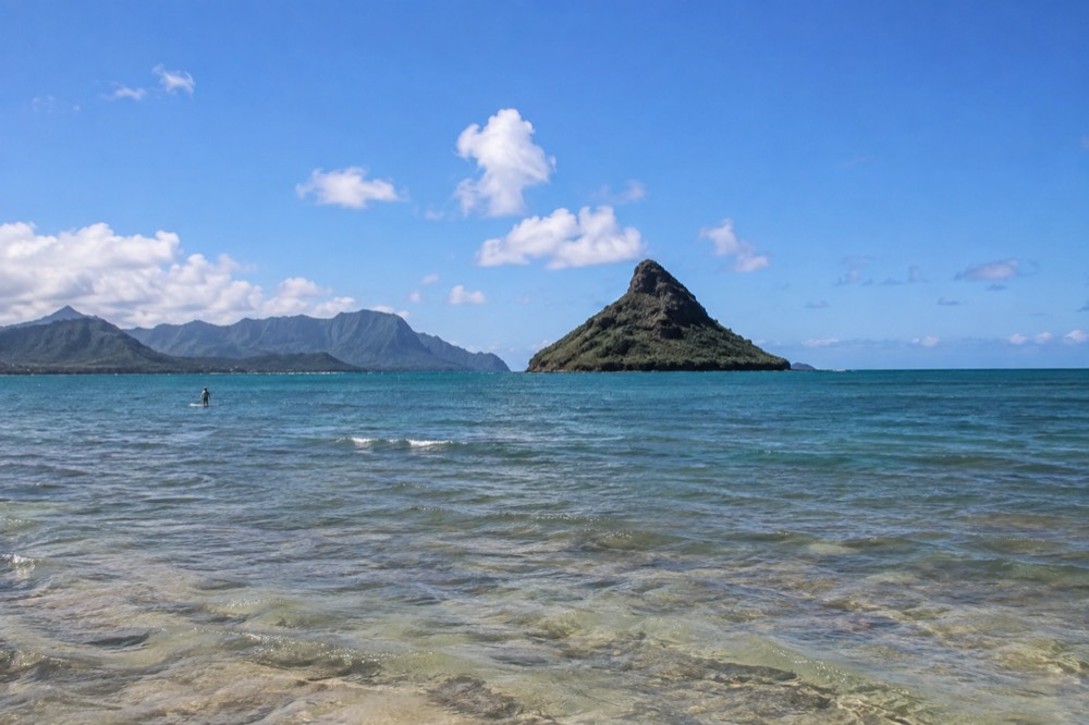
Mokoliʻi is a small offshore islet on Oʻahu's windward coast, sitting in shallow reef water directly off Kualoa Regional Park, opposite the Kualoa Ranch property. It is a remnant of the Koʻolau volcano, cut off from the ridge by erosion, and it is close enough to shore that on a calm day people paddle out to its edge.
The view of it against the green Koʻolau mountains is one of the most photographed scenes on the island.
The islet sits a few hundred metres from the beach, separated from shore by a shallow reef flat. At low tide parts of that flat stand in ankle-deep water, which is why the crossing looks deceptively easy from the highway. It is not a walk, and it is not always a swim either. It is a genuine open-water crossing, short but exposed, and the conditions change through the day.
The setting is the real draw. Mokoliʻi sits in front of the Kualoa and Kaʻaʻawa coastline, where the Koʻolau range drops almost vertically into the sea, ridgeline after ridgeline, with the flat of Kualoa Ranch and the Mōkapu peninsula framing either side of the view. Photographers line the shoulder of Kamehameha Highway here for a reason. The islet gives the composition a focal point that almost no other Hawaiian coastline offers.
Culturally, this stretch of coast matters. Kualoa is a place of deep significance in Hawaiian tradition, and the land behind the islet is private ranch property whose valleys cannot be visited except on a paid guided tour. The islet itself is best treated with restraint: admire it, photograph it from a respectful distance, and if you paddle out, understand you are approaching a natural seabird site, not a theme-park prop.
How Do You Get To Mokoliʻi From The Shore?
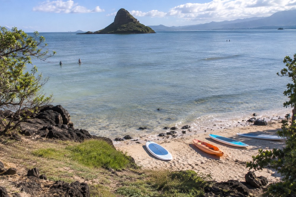
The only way to reach Mokoliʻi under your own power is to launch from Kualoa Regional Park, the beach park on the seaward side of Kamehameha Highway, and paddle or swim the few hundred metres out to the islet's edge. There is no ferry, no trail and no road. The park has parking, restrooms and a strip of sand, and wind and current, not distance, decide whether the trip is sensible.
Kualoa Regional Park is the practical base. You park on the makai, seaward, side of the highway, rig a kayak or paddleboard on the sand, and the islet sits off to the north. On a calm morning the crossing is genuinely modest for anyone with basic paddle confidence. On an afternoon with the trade winds up, the same crossing becomes a slog out and a drift home, and the reef flat around the islet is shallow enough that falling off near it means contact with coral.
A few honest cautions from the verified guidance this desk works from. Do not climb far up the islet if you land; the rock is loose, the sides are steep, and the islet is a natural seabird site rather than a maintained hiking destination. Do not expect lifeguards; this is not a lifeguarded beach the way Kailua Beach Park is. And treat the reef flat gently: standing on coral kills it, and the recommended distance from honu, green sea turtles, is about 10 feet, a guideline rather than a law, but harassment of them is illegal regardless.
If you do not have your own craft, the practical options are renting from an operator in nearby Kailua and transporting it, or joining a guided paddle. One caution for the guided route: a City and County ordinance restricts commercial tour activity at Kailua Beach Park and Kalama Beach Park, so check carefully what any operator's launch point actually is before booking anything sold as a "Lanikai" or "Kailua" kayak tour. A guided trip in the Kailua Bay kayak and snorkel tour launches from a legal commercial base and covers the Mokulua islands, the pair of islets off Kailua, which are a separate and equally scenic paddle.
For visitors without a car, the coastline around Mokoliʻi is covered by the north shore and windward day trip from Waikīkī, and the wider windward coast is covered in the Kāneʻohe and windward coast guide.
What Does A Visit To Mokoliʻi Cost?
Nothing, in fees. There is no entry charge for Mokoliʻi itself, no permit to paddle out, and no ticket for Kualoa Regional Park, which is a public beach park. Your real costs are the craft, the transport and the time: a rental kayak or paddleboard, a car or shuttle to the windward coast, and half a day of your itinerary. Anyone selling you a "Mokoliʻi access fee" is selling you something that does not exist.
That makes the islet one of the genuinely free landmarks on an island where a lot of the headline experiences carry real price tags. The contrast with its neighbour is worth stating plainly: the valleys of Kualoa Ranch behind the islet are private property, and they cannot be visited except on a paid guided tour, while the beach and the water in front of them are public.
The cost picture for a visit breaks down like this:
| Item | Cost | Notes |
|---|---|---|
| Kualoa Regional Park entry and parking | Free | Public beach park, arrive early for a stall on weekends |
| Paddling to Mokoliʻi | Free if you have a craft | No permit, no fee, no booking |
| Rental kayak or paddleboard | Varies by operator and duration | Compare Kailua-based rental operators; transport to Kualoa is on you |
| Guided paddle tours | Varies by operator | Check the actual launch point against the commercial-activity restrictions at Kailua parks |
| Kualoa Ranch valley tours | Paid, book in advance | Private property; the valleys are not accessible without a tour |
Budget one practical figure that is verified and worth knowing: if you are staying in Waikīkī and using public transport, TheBus and the Skyline rail share a fare structure, a cash single ride is $3.25, and a HOLO card caps at $7.50 per day. That said, the rail has no Waikīkī station and the windward coast is a long bus ride, so most visitors drive or take a tour. The full fare table is in the TheBus guide.
When Is The Best Time To See Mokoliʻi?
Go early, on a calm day, between roughly April and September, when the windward coast gets its most settled water and the trades have not yet built. Mornings are the window: the trades typically strengthen through the afternoon, roughening the crossing and killing the reflection shots. Winter brings larger swells that can wrap into the Kualoa shoreline, so check the surf forecast by shore aspect before you commit, not just the sky.
The single most useful thing this desk can teach you about Oʻahu ocean conditions is that the island's coasts run out of phase. North-facing shores peak in winter, south-facing shores peak in summer, and the east-facing windward coast, where Mokoliʻi sits, reacts to east and northeast swells. The National Weather Service Honolulu surf forecast publishes this as a four-aspect table for Oʻahu every day, and reading it before a windward paddle is the difference between a postcard morning and a beating.
Water temperature is rarely the problem. Harbour readings at Honolulu, which run slightly warm against open water off the windward coast, averaged 78.0 to 82.7 degrees Fahrenheit across 2025, month by month:
| Month | Mean water temp, Honolulu Harbour | Month | Mean water temp, Honolulu Harbour |
|---|---|---|---|
| January | 78.2 °F | July | 81.3 °F |
| February | 78.0 °F | August | 82.7 °F |
| March | 78.2 °F | September | 82.4 °F |
| April | 79.3 °F | October | 82.5 °F |
| May | 79.7 °F | November | 81.2 °F |
| June | 80.6 °F | December | 80.4 °F |
Daylight matters more than warmth. Oʻahu's day length swings only about two and a half hours across the year, and sunset never gets later than about 7:17 p.m., so there are no long summer evenings to rescue a late start. In mid-January the sun does not rise until about 7:11 a.m., which shortens the calm-water window at the time of year you most want one.
One closure note for anyone combining the islet with a wider windward loop: Nuʻuanu Pali State Wayside, the Pali Lookout above Kāneʻohe, and Kaʻena Point State Park are both closed until further notice as of the DLNR notice of 9 September 2026, following Hurricane Lowell repairs. Plan around them rather than assuming the classic lookout stops are open.
Is Paddling Out To Mokoliʻi Actually Safe?
For a confident paddler on a flat morning, yes, with the usual open-water caveats: check the surf forecast for the east-facing shore, go before the trades build, wear a leash, and do not attempt the crossing if wind, chop or current look wrong. The crossing is short but it is real open water over a shallow reef, and conditions on the windward coast can change within an hour.
The honest risk profile is ordinary ocean risk, concentrated. The distance is short, which lulls people. The water is shallow over the reef flat, which means falling means coral contact. The trades build predictably through the day, which means the paddle back is harder than the paddle out if you start late. And there is no lifeguard at Kualoa Regional Park, so your safety margin is entirely the equipment and judgement you brought.
Anyone who is not a confident swimmer should experience Mokoliʻi from the beach, a boat, or the highway shoulder instead. There is no shame in that call, and the shoreline view is nearly as good.
The basics that apply across Oʻahu apply doubly here. Check the daily surf forecast by shore aspect. Check the ocean safety guide for the island-wide rules of thumb. If box jellyfish are a concern on a south-shore swim, the windward coast is a different exposure, but the jellyfish calendar is still worth a glance in summer months. And keep the wildlife distances straight: whales at 100 yards and spinner dolphins at 50 yards are law, while the 10 feet for honu and 50 feet for monk seals are recommended guidelines, with harassment of any of them illegal regardless.
If the crossing is not for you, the shoreline experience is still excellent. The beach at Kualoa Regional Park looks straight at the islet, the water is shallow and sandy in parts, and the photographic composition from the sand is nearly as good as from the water. Plenty of visitors, including most families with young children, treat it purely as a viewpoint, and lose nothing by it.
What Else Is There Around Mokoliʻi?
The islet shares its stretch of coast with some of the strongest sightseeing on Oʻahu: Kualoa Ranch's valley tours, the Mōkapu peninsula viewpoint at the south end of the park, the Kāneʻohe Bay coastline to the north, and the Kailua and Waimānalo beaches to the south. Most visitors pair Mokoliʻi with at least one of these, and a full windward day can absorb all of them.
The limiting factor is not distance, it is parking and time. Kualoa Regional Park fills on weekends, and the ranch's tours book out ahead of peak dates, so a windward day rewards a plan more than it rewards spontaneity.
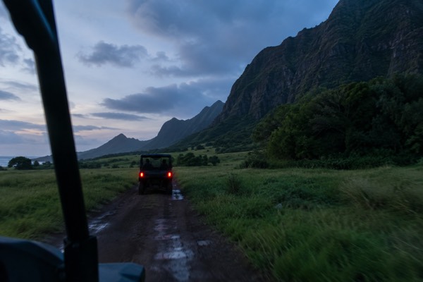
Kualoa Ranch is the obvious pairing. The ranch's valleys and film locations sit directly behind the islet, and the property is private, so a paid tour is the only legitimate way in. Two products cover the same ground at different intensities: the ranch's own UTV adventure, and the shorter Hollywood film locations tour.
If a ranch tour does not fit the schedule or the budget, the water option on this coast is the guided paddle from Kailua, which reaches the Mokulua islands rather than Mokoliʻi but delivers the same offshore-islet experience with a guide, gear and a legal launch point included.
South of Kualoa, the coast runs through Kailua and Waimānalo, two of the island's best beach towns, covered in the Kailua guide. North, the road climbs toward Kaʻaʻawa and the long green wall of the Koʻolaus, one of the finest drives on the island. A comparison of how the windward coast stacks up against the North Shore as a day out is in Waikīkī vs North Shore: where to stay, and the full sightseeing menu is in things to do in Oahu.
For visitors who want the whole windward coast in one guided day, two products dominate:
Prefer to let a guide handle the full island loop? Book a circle island tour here.
A circle-island tour is worth a specific mention because it solves the two problems a self-drive windward day creates: the parking pressure at Kualoa, and the temptation to stop in travel lanes on Kamehameha Highway, which is a genuine hazard on this coast.
Is Mokoliʻi Worth The Trip?
Yes, with the right expectations. As a viewpoint and a photography stop it is unmissable, free, and ten minutes from the highway. As a paddle it is a rewarding short crossing for confident paddlers on a calm morning, and a bad idea for everyone else. What it is not is a half-day attraction on its own. Pair it with Kualoa Ranch, a Kailua beach afternoon, or a full windward day, and it earns its place easily.
The fairest way to size it:
| If you are... | Mokoliʻi is... | Best plan |
|---|---|---|
| A confident paddler | A short, scenic open-water crossing | Launch from Kualoa Regional Park early morning, April to September |
| A photographer | One of the best compositions on Oʻahu | Highway shoulder or beach at golden hour; the islet faces the morning light |
| A family with kids | A beautiful backdrop, not a destination | Beach time at Kualoa Regional Park, islet as the view |
| On a circle-island tour | A window highlight | Let the driver pick the stop; the coastline is visible for miles |
| Short on time | A ten-minute photo stop | Pull into the regional park, take the shot, move on |
The verdict from this desk: the windward coast is one of the two or three finest stretches of landscape on Oʻahu, and Mokoliʻi is its signature. Go early, check the east-shore surf forecast, treat the islet and its reef with care, and give the rest of the Kualoa coastline the time it deserves. That is the whole visit, and it is a good one.
Common Questions About Visiting Mokoliʻi On Oʻahu
Most questions about Mokoliʻi come down to three things: how you physically reach it, what it costs, and whether the crossing is safe. The answers are short, because the visit is simple: it is a free public islet off a free public beach park, reached only by paddling or swimming a few hundred metres, and the decision that matters is whether the day's wind and swell make that crossing sensible.
Everything else, tours, timing and alternatives, is arrangement around that core.
Can you walk to Mokoliʻi at low tide?
No. The islet sits a few hundred metres offshore over a shallow reef flat, and even at low tide the crossing is a swim or a paddle, not a walk. Attempting to wade it means hours standing on and damaging live coral, and the water is deeper than it looks from the highway. Use a kayak or paddleboard, or enjoy it from the beach.
Is Mokoliʻi free to visit?
Yes. There is no fee, permit or reservation for the islet or for Kualoa Regional Park, the public beach park opposite it. Your only costs are equipment rental and getting to the windward coast. The private ranch valleys behind it are a separate, paid experience.
Do you need a permit or reservation to paddle to Mokoliʻi?
No. The crossing is unregulated public water and the launch point is a public park. No reservation system exists for it, unlike, say, Hanauma Bay, which opens reservations two days ahead at 7 a.m. HST and closes Mondays and Tuesdays. You are simply responsible for your own safety on the water.
What is the best time of day to photograph Mokoliʻi?
Early morning. The islet faces the sunrise, the trades are lightest before mid-morning, and the water is at its calmest and most reflective. Sunset on this coast is behind the mountains, so the evening light goes flat and backlit. The latest sunset of the year on Oʻahu is only about 7:17 p.m., so there is no long golden evening to fall back on.
Can you climb Mokoliʻi?
The islet has a rough, unmaintained slope that people do climb, but this desk does not recommend it. The rock is loose and steep, there is no maintained trail, and the islet is a natural seabird site rather than a hiking destination. The view from the water and the beach is the better experience, and the honest one.
What is the island off Kualoa called?
Its Hawaiian name is Mokoliʻi, and that is the name this site uses. The old English nickname that appears on some maps and souvenirs is a colonial-era name that modern Hawaiian editorial practice has dropped. "The small island off Kualoa" is the plain-language description if you need one.