Makapuu Point Lighthouse Trail: What The Hike To Oʻahu's Easternmost Lookout Really Involves
The Makapuu Point Lighthouse Trail is a paved, mostly exposed climb along Oʻahu's southeastern tip to a lookout above a small white lighthouse perched on black lava, with the whole windward coast laid out below. Here is what the walk actually involves, what it costs, and whether it deserves a slot in your itinerary.
Short answer
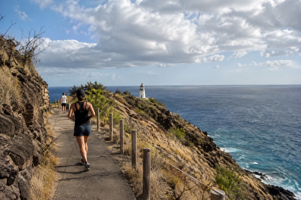
The Makapuu Point Lighthouse Trail is a paved, stroller-friendly walk of roughly two miles round trip on Oʻahu's southeastern point, free to access with no reservation required, reaching a lookout above the lighthouse rather than the lighthouse itself. Go early morning or late afternoon, bring water, and skip midday in summer. It is worth it for the coastline views alone, and doubly so between November and April when humpback whales pass the point.
The Makapuu Point Lighthouse Trail does one thing and does it well: it takes you, on pavement, from the side of Kalanianaʻole Highway up the spine of Oʻahu's southeastern tip to a lookout above a small white lighthouse. On the way it hands you Waimānalo, the Mokulua Islands, and on a clear day the outline of Molokaʻi and even Lānaʻi. This page covers the practical questions people actually ask before they go: what it costs, when to walk it, whether kids and grandparents can manage it, and whether it earns its place on a short trip.
One thing this trail is not: a route to the lighthouse itself. The tower sits below the trail's end on its own ledge, and the access track down to it is closed to the public. You finish at a lookout above and behind it. That distinction matters, because a fair number of visitors arrive expecting to stand next to the tower and leave slightly confused about why they cannot.
Where Is The Makapuu Point Lighthouse Trail On Oʻahu?
The trailhead sits on the southeastern coast of Oʻahu, on Kalanianaʻole Highway between Hawaiʻi Kai and Waimānalo, inside the Kaiwi State Scenic Shoreline. It is the easternmost point of the island's accessible trail network, about a 30 to 40 minute drive from Waikīkī depending on traffic, and it shares its stretch of coast with Sandy Beach, the Hālona Blowhole and Sea Life Park. The highway is the island's scenic southeastern loop, so most visitors reach it as part of a drive that strings several stops together.
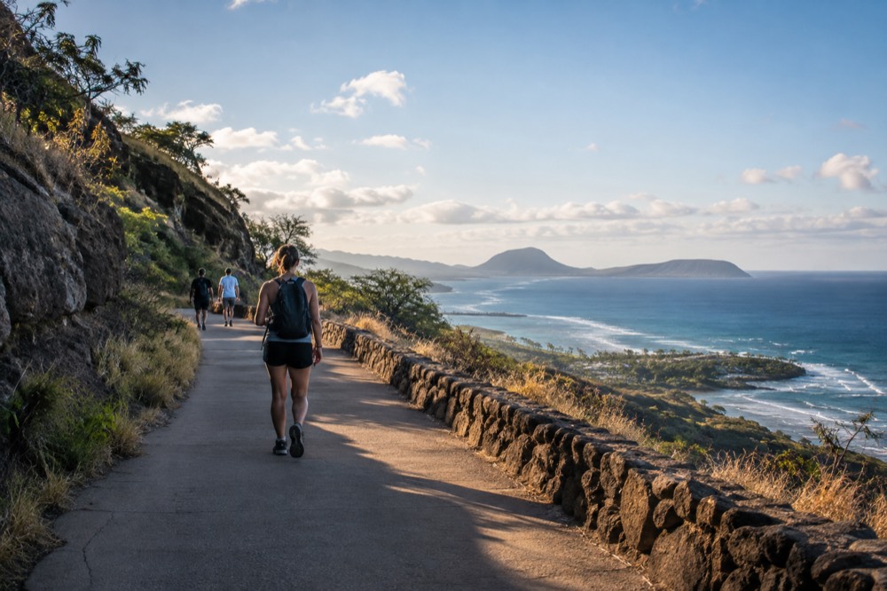
The trail climbs the ridge above the point itself. From the upper switchbacks you look back along the coast you just drove: Sandy Beach Park below to the west, the Hālona Blowhole beyond it, and the Waimānalo shore curving away to the northeast. Directly offshore sit the Mokulua Islands off Kailua, and on the clearest winter days the silhouette of Molokaʻi hangs on the horizon to the east.
Because the trailhead is a highway pullout rather than a developed park entrance, it is easy to overshoot. The lot is on the makai, ocean side of the road, signed for the Kaiwi State Scenic Shoreline. If you find yourself descending toward Waimānalo with the lot behind you, you have gone too far.
For planning the rest of the day, our best Oʻahu day trips guide covers how to chain the southeastern coast into a loop, and the Hawaiʻi Kai neighborhood guide covers the towns you drive through to get there.
How Much Does The Makapuu Lighthouse Trail Cost?
Nothing. The trail is free to walk, with no entry gate, no reservation system and no permit, and parking at the trailhead lot is free too. That puts it in a small and shrinking group of Oʻahu lookouts that require neither money nor a booked time slot, a genuine contrast with Diamond Head, where out-of-state visitors now need a reservation and pay per person and per vehicle.
The comparison is worth spelling out, because it shapes how people plan. Oʻahu's two most famous walks sit at opposite ends of the logistics spectrum:
| Trail | Entry cost (non-resident) | Reservation needed | Walk surface |
|---|---|---|---|
| Makapuu Point Lighthouse Trail | Free | No | Paved |
| Diamond Head (Lēʻahi) | $5 per person, $10 per vehicle | Yes, for entry and parking, since May 2022 | Paved and unpaved sections |
| Mānoa Falls Trail | Trail free; parking charged by a private lot, fee unverified | No | Unpaved, mud-prone |
The Diamond Head reservation requirement has been in force since 12 May 2022 and is permanent, and a large amount of older content online still describes it as a turn-up-and-pay walk. If you want the reservation-free experience, Makapuu is the one that still works that way.
If you would rather not think about any of this, the guided Diamond Head option below bundles the ticket and the shuttle so the reservation is simply handled:
When Is The Best Time Of Day To Walk The Makapuu Lighthouse Trail?
Early morning, before about 9 a.m., is the best time: cooler air, softer light for photography, lighter parking pressure and calmer trade winds than midday. Late afternoon is the second-best window, and the trail stays walkable until sunset, which in midsummer falls around 7:15 p.m. Midday between 11 and 3 is the worst slot, because the trail is fully exposed with almost no shade and the pavement radiates heat back at you. Sunrise hikers get the added bonus that the light comes from behind them, lighting the windward coast and the offshore islands.
There is a real astronomical constraint worth knowing: Oʻahu is close enough to the equator that its day length barely changes. The longest day of the year, around 21 June, runs about 13 hours 26 minutes, and the shortest, around 21 December, about 10 hours 51. Sunset never gets later than about 7:17 p.m., and in midwinter it is closer to 6 p.m. There are no long northern-latitude summer evenings here, so a "sunset hike" in January means starting by 4:30 at the latest.
For visitors who like the idea of a lookout day but would rather someone else handle the route and the parking, these are the three options that pair most naturally with this coast:
Is The Makapuu Lighthouse Trail Difficult?
It is a moderate, steady climb on a fully paved path, gaining roughly 500 feet over about a mile, and most reasonably fit walkers complete it in 30 to 45 minutes each way. There is no shade, no water and no restroom on the trail itself, only at the trailhead lot. The surface is smooth enough for strollers and mobility devices, though the grade is sustained, and the return trip is downhill and easy. It is not a scramble, not a jungle hike, and not a ridge walk; think of it as a long ADA-style ramp with a view.
The honest difficulty assessment depends almost entirely on heat. On a February morning with a breeze it is pleasant for nearly everyone. On an August afternoon with the sun directly overhead it becomes a test of how much water you brought, and heat exhaustion is a real risk for anyone who starts the climb at 1 p.m. with a single small bottle. The trail's dry, cactus-dotted hillsides look more like the American Southwest than the rainforest most visitors picture when they book Hawaiʻi, and that surprises people both ways: some find the landscape starkly beautiful, others are disappointed it is not green.
Who it suits well:
| Walker type | Fit for this trail? | What to watch |
|---|---|---|
| Families with a stroller | Yes, the pavement is smooth and wide | Sustained grade; little ones overheat fast with no shade |
| Older walkers | Usually yes, taken slowly | Benches along the way; rest at each viewpoint |
| Very young children walking | Yes but slow | Keep hold near the upper lookout; there are unfenced drops |
| Serious hikers | No, too short and too paved | Treat it as a viewpoint, not a hike |
| Wheelchair and mobility-device users | Yes, with assistance on the grade | No shade rest points mid-trail |
If the paved lookout walk sounds good but you also want a greener, sweatier day elsewhere in the week, the rainforest waterfall walk below is the better product for that, and it comes from the same operator family of self-guided options with transport included:
Can You See Whales From The Makapuu Lighthouse Trail?
Yes, and it is one of the best free shore-based whale-watching spots on Oʻahu. Humpback whales are present in Hawaiian waters from November through April, the window stated by the Hawaiian Islands Humpback Whale National Marine Sanctuary, and the trail's clifftop vantage above deep water puts you directly over their travel corridor. Bring binoculars; the whales are often farther offshore than they look, and blows, flukes and full breaches are all visible from the upper lookout.
Want to see the whales from the water instead? Book a whale watching tour here.
The sanctuary's own guidance is that visitors can see whales from shore and at sea during that window, and this stretch of coast is exactly the kind of elevated, open-ocean vantage that makes shore watching productive. There is no verified "peak month" to name, so the honest advice is simply that mid-season, roughly January to March, gives you more sightings than the shoulder weeks of November and April, without promising any single month.
Two things to keep straight about the rules. On the water, 100 yards from a humpback is law, and 50 yards from Hawaiian spinner dolphins is law as well. From the clifftop you are not approaching anything, so those distances do not constrain you, but if you later book a boat the operator is bound by them. And the whales are here to calve and mate in warm, shallow water; watching quietly from a lookout is about as low-impact as wildlife viewing gets.
What Should You Bring, And What Should You Not?
Bring more water than feels reasonable, sun protection including a hat and sunscreen applied before you start, and footwear with grip even though the path is paved, because the pavement can be slick near the top in wind-blown spray. Do not bring drones: flying one is prohibited in Hawaiʻi state parks without a written permit, and this trail is inside the state scenic shoreline. Do not take rocks, and keep to the paved path at the lookout.
The drone point deserves emphasis because this trail tempts it: the lighthouse, the cliffs, the turquoise water, everything about the view says "aerial footage". The prohibition in state parks is not a guideline, and enforcement at popular trailheads is real. The rock-taking point matters too. Removing rocks and sand from the shoreline is prohibited under state law, and the reason to give is the law itself, not folklore about curses, which is a modern invention rather than a Hawaiian tradition.
A short packing table for the walk:
| Item | Bring it? | Why |
|---|---|---|
| Water, 1 litre or more per person | Essential | No water on the trail, full sun exposure |
| Hat and sunscreen | Essential | Almost no shade anywhere on the route |
| Binoculars | Worth it | Whales in season, seabirds year-round |
| Grip-soled shoes | Recommended | Smooth pavement, occasionally damp near the top |
| Drone | Leave it | Prohibited in state parks without a permit |
| Speaker | Leave it | The quiet is part of what the point offers |
Is The Makapuu Lighthouse Trail Worth It?
For most visitors, yes, and the reason is efficiency: it delivers a genuine clifftop panorama, a lighthouse, seasonal whale watching and a workout in under two hours, for free, with no reservation, on a route almost anyone in your group can walk.
It is worth less to visitors staying in Waikīkī without a car, who would spend more time in transit than on the trail, and it is worth skipping on a windy, rainy day when the exposure makes it miserable.
The strongest version of the trip is to fold it into a southeastern coast drive rather than treating it as a standalone outing. Sandy Beach Park, the Hālona Blowhole and this trailhead sit within a few minutes of each other, and Waimānalo Beach stretches out beyond. Walkers with more appetite for the windward side can continue into Kailua territory or turn inland toward Kāneʻohe.
One planning caution for the wider itinerary: if your route was going to include the Nuʻuanu Pali Lookout, check before you go. As of the state parks notice dated 9 September 2026, the Pali Lookout is closed until further notice for storm repairs following Hurricane Lowell, along with Kaʻena Point and Wahiawā Freshwater, so any itinerary built from older content needs a fresh check.
If you would rather have someone else assemble the lookout-heavy day, the half-day scenic tour below visits multiple viewpoints with transport handled:
What About The Nearby Lookouts, And Can A Tour Cover Them?
Yes, and for visitors without a rental car a guided lookouts tour is often the practical way to see this coast, since the trailhead has no transit connection worth the name and the southeastern stops are spread out along a highway built for driving.
A half-day scenic tour that stacks several lookouts into one morning gives you the same photo stops with the parking and the route decided for you, and it pairs naturally with a guided Diamond Head walk on a separate day.
The trade is control versus convenience. Driving yourself means leaving when you want and lingering at the upper lookout as long as the whales keep surfacing. A tour means you ride in air conditioning, learn the history of the coast from a guide, and never circle a full parking lot at 10 a.m. Both are legitimate choices, and the deciding factor is usually whether you have a car and whether you enjoy driving unfamiliar coastal highways.
For the fuller picture of what the island offers beyond this coast, start with the master list on Oahu Travel Guide and work outward from there.
Common Questions About The Makapuu Point Lighthouse Trail
Most questions about this trail come down to three things: the walk is free and needs no reservation, the path is paved but fully exposed to sun, and the payoff is a lookout above the lighthouse rather than access to it. Everything else, from whale timing to parking, follows from those three facts. Here are the specific questions visitors ask most often.
Is the Makapuu lighthouse trail paved?
Yes, the entire route from the trailhead lot to the upper lookout is paved asphalt, wide enough in most places for a small vehicle. That is what makes it usable by strollers and, with help on the grade, by wheelchair users. Paved does not mean flat: the climb is steady and there is no shade anywhere on it.
How long is the Makapuu lighthouse trail?
Roughly two miles round trip, out and back on the same path. Most walkers budget 1.5 to 2 hours including time at the top, and fit hikers do it faster. It is a short walk with a view far bigger than its length.
Do you need a reservation for the Makapuu lighthouse trail?
No. There is no entry fee, no booking system and no gate. This is one of the few major Oʻahu lookouts that still works on a simple turn-up basis, unlike Diamond Head, where non-residents have needed reservations for entry and parking since May 2022.
Can you walk down to the lighthouse itself?
No. The lighthouse sits on a ledge below the end of the public trail, and the old access track down to it is closed to visitors. The trail ends at a lookout above and behind the tower, which is where the classic photographs are taken from.
When can you see whales from the Makapuu lighthouse trail?
Humpback whales are in Hawaiian waters from November through April, per the Hawaiian Islands Humpback Whale National Marine Sanctuary, and this clifftop is a strong shore-watching vantage during that window. Bring binoculars and scan for blows, which show up against open ocean better than the animals themselves do.
Is the Makapuu lighthouse trail suitable for kids?
Generally yes, because the pavement makes the footing simple and the length is modest. The caveats are heat, since children overheat quickly with no shade, and the upper lookout, where the ground beyond the railing drops away steeply, so hold young children's hands there and keep everyone on the path.
The trail will not be the most dramatic thing you do on Oʻahu, and it does not need to be. It is the dependable one: free, reservation-free, walkable by nearly everyone, and positioned on a coast that rewards the drive with a dozen other stops on the way home.