What Is The Most Beautiful Hike In Oahu?
A direct, sourced answer on the most beautiful hike in Oahu, with honest comparisons of Mānoa Falls, Diamond Head, Koko Crater and the trails currently closed for storm repairs.
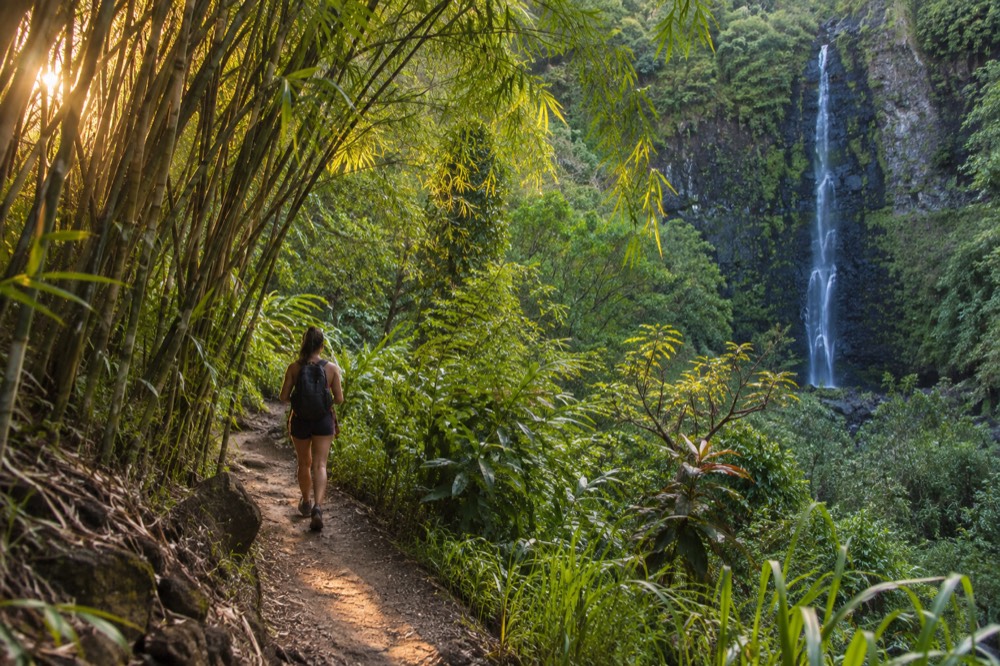
The Mānoa Falls trail is the most beautiful hike on Oʻahu for most people: a paved-then-rooted rainforest path through bamboo and ginger, five miles from Waikīkī, ending at a roughly 150-foot waterfall that drops in a thin white ribbon down a dark cliff. It is free to walk, it takes a morning, and it looks nothing like the postcard beaches most visitors associate with the island.
That is the direct answer, and it comes with an honest caveat. Beauty on this island splits by terrain. If your idea of a beautiful hike is a coastline panorama rather than a jungle corridor, the answer changes, and a couple of the strongest contenders are closed for storm repairs as of September 2026. This article walks through the winner, the runners-up, the closures, and the practical details that decide which one you should actually book time for.
What Is The Most Beautiful Hike In Oahu?
The Mānoa Falls trail is the most beautiful hike on Oʻahu for most visitors. It climbs gently through a rainforest valley, passing bamboo groves and wild ginger, and ends at a waterfall roughly 150 feet high dropping down a sheer basalt face. The trail is free, the walk takes most people about an hour and a half round trip, and the valley sits only five miles from Waikīkī, the easiest dramatic scenery on the island to reach.
The reason Mānoa wins is rainfall, and that is not a figure of speech. The valley sits on the windward side of the Koʻolau range, where the trade winds push clouds up the valley walls and the water falls out of them. The Lyon Arboretum weather station in Mānoa records an annual normal of 150.96 inches of rain, against 16.41 inches at Honolulu airport on the leeward coast, roughly five miles away. Every single month in Mānoa is wetter than the airport's wettest month. That is why the trail runs through genuine rainforest while Waikīkī sits in a near-desert microclimate, and it is why the waterfall keeps flowing through the drier parts of the year when other Oʻahu falls slow to a trickle.
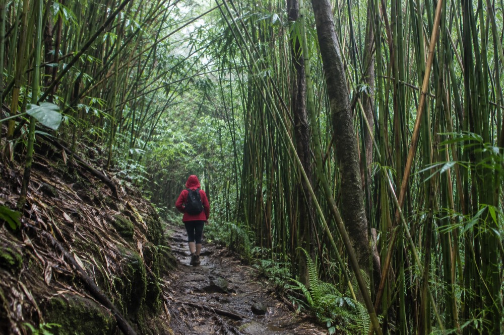
The trail surface is where expectations need managing. The first stretch is paved, then the path becomes dirt and tree roots with sections that turn to mud after rain, which in this valley means most of the time. Closed shoes with grip are the difference between a pleasant walk and a slippery one. The waterfall pool at the end is not for swimming; the area is roped off, and flash floods in the narrow gorge are a real hazard, which is covered in detail in our Mānoa Falls trail guide.
There is also a timing question that gets almost no attention in competing guides. Because the valley makes its own weather, the trail is at its best in the morning, when the clouds are still lifting off the ridge and the light comes sideways through the bamboo. By early afternoon the gorge is often socked in, the footing is at its worst from the day's first walkers, and the waterfall view can disappear into mist. An early start buys better light, drier ground and a quieter path, and it costs nothing.
For walkers who want the scenery without renting a car, there is a self-guided option that handles the transport from Waikīkī, and it pairs naturally with the trail:
The comparison below is the honest shortlist. Difficulty is subjective, but the terrain and the payoff are not.
| Hike | What you see | Effort | Cost |
|---|---|---|---|
| Mānoa Falls | Rainforest, bamboo, a roughly 150 ft waterfall | Easy to moderate, muddy after rain | Trail free |
| Diamond Head (Lēʻahi) | Crater interior, panoramic coastline from the summit | Moderate, paved then stepped | $5 per non-resident plus $10 to park |
| Koko Crater Railway Trail | Old rail ties climbing a crater rim, east coast views | Hard, steep and exposed | Free |
| Lanikai Pillbox | Two WWII lookout structures, Mokulua islands view | Moderate, exposed and slick | Free |
| Mākapuʻu Point Lighthouse Trail | Paved coastal path, lighthouse, ocean horizon | Easy | Free |
Why Does Mānoa Feel Nothing Like Waikīkī?
The trade winds are the reason. They push moist air up the Koʻolau mountains, the air cools as it rises, and the water falls out as rain on the windward valleys while the leeward coast stays dry. Mānoa receives 150.96 inches of rain a year against 16.41 inches at Honolulu airport, five miles away, a nine-fold difference across a short drive.
You can stand in a near-desert at the beach and walk into a rainforest within half an hour.
This is the single most useful piece of planning knowledge on this page, and almost no competing guide states it with numbers. The National Centers for Environmental Information's 1991 to 2020 climate normals put the Lyon Arboretum station in Mānoa at 150.96 inches of annual precipitation, with July, a summer month, the wettest at 15.35 inches. Honolulu airport, on the leeward side, gets 16.41 inches across the entire year. The practical consequence for a hiker: you can trust the Mānoa Falls trail to be green and the waterfall to be running in any month, but you should also trust it to be muddy, and you should not judge the day by the blue sky over your hotel.
The middle ground between the two extremes is worth knowing too. The Kāneʻohe Bay station on the windward coast records 27.82 inches a year, sitting between the desert of the airport and the downpour of the valley. That gradient explains the whole geography of hiking on this island: the further a trail sits into the windward valleys, the greener and wetter it will be, and the leeward trails, the ones on the Waiʻanae side, will be hot, dry and exposed by comparison. Choosing between them is really choosing which of those two islands-within-an-island you want to walk in.
The valley also carries a cultural weight that the trail signs only hint at. Mānoa was a place of intensive rain-fed agriculture and deep residence before the hotel era, and the land is still lived in by the community that gives the neighborhood its name. Walk it as a guest, stay on the marked path, and leave the rocks where they lie; removing rock or soil from the shoreline and lands of Hawaiʻi is prohibited by law, and stacked stone cairns, whatever their origin, disturb both habitat and archaeological surfaces.
If a morning in the jungle sounds good but you would rather have the island's classic panorama, the next two sections cover the strongest alternatives, one easy and one punishing.
Is Diamond Head The Best View Hike On Oahu?
Diamond Head, the crater the Hawaiian language calls Lēʻahi, is the best view-per-effort hike on the island. The trail climbs through the crater interior and a tunnel to a fire-control station at the rim, where the panorama takes in Waikīkī and the south coast. Out-of-state visitors pay $5 per person plus $10 per vehicle, and a reservation is mandatory for both entry and parking, with no tickets sold at the gate.
The reservation rule dates from May 2022 and it is permanent, and a large share of the advice online still predates it. Non-residents book entry and parking in advance, up to 30 days ahead, and the gate takes credit card only. Hawaii residents walk in free with state ID. The hours run 6 a.m. to 6 p.m. daily except Christmas and New Year's, with the last reservation at 4 p.m. and last entry at 4:30 p.m.
Is it the most beautiful? Not by the jungle standard, but it is the most beautiful short climb with a guaranteed payoff, and it is the hike most first-time visitors should actually do, which is a different question from the one in the title. The full picture, including the trail's history and the reservation mechanics, is in our Diamond Head State Monument guide.
For visitors who would rather not wrestle the reservation system themselves, this guided option bundles the ticket and the shuttle:
If you are still weighing whether a guided ticket is worth it against going alone, the honest answer is that the trail itself is identical either way. What the package buys is the reservation, which is mandatory and can sell out on busy days, and the shuttle, which removes the parking question entirely. Cancellation terms are on the operator's live listing, and checking them before you commit is worth the minute it takes.
What Is The Hardest Beautiful Hike On Oahu?
The Koko Crater Railway Trail is the hardest hike that most visitors still call beautiful. It climbs an abandoned military supply railway, stair-stepping on old rail ties straight up the crater's inner flank, with no shade and no bailout once you are committed. The reward at the top is a full sweep of the east coast from Mākapuʻu to Honolulu, and the trail is free.
Locals run it before work, and they make it look easy, which it is not. The grade is relentless, the ties are uneven, and the sun off the exposed rock is serious business by mid-morning. Start early, carry more water than feels reasonable, and skip it entirely on hot days if you are not used to sustained climbing. Going down is its own skill test: the ties demand attention, and tired legs turn the descent into a slow, deliberate exercise.
The trail is also called Koko Head Stairs, and it should not be confused with the Stairway to Heaven, the Haʻikū ladder on the same ridge system, which is closed to the public and not a hike this site will ever direct you toward. The legal, open climb is the railway, and the details are in our Koko Crater trail guide.
One honest note on beauty here. Koko Crater is not lush; it is a dry, golden crater with an ocean view that gets better with every step. If your mental image of a beautiful hike is green and dripping, this is not it, and Mānoa remains your answer. But if a hard climb with a horizon payoff sounds like your kind of morning, nothing else on the island delivers the same ratio of effort to panorama, and the sunrise start, before the heat and the crowds, is the version locals recommend.
Which Beautiful Oahu Hikes Are Closed Right Now?
Two of Oahu's most scenic walking destinations are closed as of September 2026: Nuʻuanu Pali State Wayside and Kaʻena Point State Park, both shut until further notice for repairs after Hurricane Lowell, along with Wahiawā Freshwater State Recreation Area. The DLNR notices dated 9 September 2026 list all three as closed. Any itinerary that includes the Pali Lookout or a Kaʻena sunset walk needs a replacement, and the situation is changing week to week.
Kaʻena Point deserves a word beyond the closure notice, because it is not simply a scenic spot. In Hawaiian tradition the point is a leina a ka ʻuhane, a place where souls depart the living world, and it sits behind a predator-proof fence protecting seabirds and Hawaiian monk seals. When it reopens, it is a place for restraint and quiet, not a photo backdrop. The Pali Lookout, meanwhile, is the classic windward panorama stop, and its closure is a real loss for visitors who wanted the cliff-edge view of Kāneʻohe Bay without hiking for it.
| Site | Status | What to do instead |
|---|---|---|
| Nuʻuanu Pali State Wayside | Closed until further notice, storm repairs | Tantalus Lookout at Puʻu Ualakaa State Park for a city-and-ocean panorama |
| Kaʻena Point State Park (Mokuleʻia and Keawaʻula sections) | Closed until further notice, storm repairs | Mākaha or Waiʻanae beaches on the leeward coast, or postpone |
| Wahiawā Freshwater SRA | Closed until further notice, storm repairs | Hoʻomaluhia Botanical Garden on the windward side |
| Mānoa Falls trail | Open | No change needed |
| Diamond Head State Monument | Open, reservation required for non-residents | Book ahead, up to 30 days |
Before you build a day around any of the closed sites, check the DLNR State Parks notices, because the reopenings will not be announced evenly and this page's closure table will age. The general rule for September 2026: the island's hiking core, the trails from Mānoa to Koko Head, is unaffected by the storm closures.
What Should You Actually Book For A Hiking Day On Oahu?
Book Diamond Head for the classic panorama and Mānoa Falls for the rainforest, in that order if you only have one morning each, and leave Koko Crater for a day when you are rested and up early. A guided Diamond Head package handles the mandatory reservation and the shuttle; a self-guided Mānoa option covers transport.
Both are half-day commitments, so a fit visitor can do one in the morning and still have an afternoon at the beach.
The economics matter less than the logistics. The hard part of Diamond Head is not the climb, it is the reservation, and the hard part of Mānoa is not the trail, it is getting there without a car, since the bus connection from Waikīkī is slow enough to eat half the day. Guided products solve exactly those two problems, which is why they are the ones worth paying for; the trails themselves are cheap or free, and no one should sell you an expensive version of a walk.
For visitors who want scenery without hiking at all, the lookouts tour below covers seven viewpoints in a half day from Waikīkī, which is the honest alternative for anyone in the group whose knees have opinions about rail ties.
Common Questions About The Most Beautiful Hikes In Oahu
Most questions about beautiful Oahu hikes come down to four things: whether the trail is open, whether it needs a reservation, what the footing is like, and how to get there without a car. Mānoa Falls is open, free and muddy; Diamond Head is open, paid and reservation-only for visitors; Koko Crater is open, free and steep; the Pali Lookout and Kaʻena Point are closed for storm repairs as of September 2026.
Sort those four facts and the rest is taste.
What is the most beautiful hike in Oahu?
The Mānoa Falls trail. It is a rainforest walk through bamboo and ginger to a roughly 150-foot waterfall, five miles from Waikīkī, free to enter, and green in every month because the valley receives 150.96 inches of rain a year. If your definition of beautiful is a coastal panorama rather than jungle, Diamond Head's summit view is the strongest alternative.
Is the Mānoa Falls hike hard?
No. Most walkers finish the round trip in about an hour and a half on a gentle grade. The real difficulty is footing: the dirt sections turn muddy after rain, and in Mānoa that means most days. Wear closed shoes with grip, and skip the trail in heavy rain because the waterfall gorge carries a flash-flood risk.
Can you swim at Mānoa Falls?
No. The pool at the base is roped off, and the risk in the narrow gorge is real. Treat the waterfall as the destination and the view as the activity.
Do you need a reservation for Diamond Head?
Yes, if you are not a Hawaii resident. Non-residents must reserve both entry and parking in advance, up to 30 days ahead, and there are no on-site sales. Entry is $5 per person plus $10 per vehicle, credit card only. Residents enter free with Hawaii ID.
Is Koko Crater harder than Diamond Head?
Yes, considerably. Koko Crater climbs old rail ties with no shade the whole way, against Diamond Head's shorter, partly paved climb. A walker who finds Diamond Head manageable may still find Koko Crater a serious workout, especially in midday heat.
Are any Oahu hikes closed right now?
Yes. Nuʻuanu Pali State Wayside and Kaʻena Point State Park's Mokuleʻia and Keawaʻula sections are closed until further notice for repairs after Hurricane Lowell, per DLNR notices dated 9 September 2026, along with Wahiawā Freshwater State Recreation Area. Check the DLNR notices before planning around either site.
Whichever trail you pick, the honest summary is this: Oʻahu's beauty is not one landscape but several stacked within a few miles of each other, and the island's best hiking day pairs a rainforest morning in Mānoa with a golden-hour look at the coast from wherever your legs have left you. More on planning the rest of the trip, reservations and all, is on the Oahu Travel Guide homepage.