Oahu Flash Flood Safety: What Every Visitor Needs To Know
Flash floods on Oahu kill people in places that looked sunny an hour earlier. Here is how the island's rainfall works, which spots carry the most risk, and what to do when the water starts rising.
Short answer
Flash floods on Oahu are caused by rain falling high in the Koʻolau mountains, often while the coast stays dry. Never cross rising water, check the forecast for the valley rather than the beach, and get to high ground immediately if a stream starts to rise or turn brown.
Oahu Flash Flood Safety: What Every Visitor Needs To Know
Flash floods on Oahu are a mountain-rain problem, not a beach problem: most of the island's rain falls high in the Koʻolau range and funnels down narrow valleys, so a stream can go from ankle-deep to lethal while the coast below stays in full sunshine. The rule that saves lives is simple: never enter or cross rising water, and move to high ground the moment a stream starts to rise, turn brown, or roar louder.
That rule feels obvious written down. It is less obvious standing at the base of a waterfall at 10 a.m. with blue sky overhead, which is exactly the situation that catches visitors. The rain that floods the valley below you may be falling a mile upslope and out of sight behind the ridge. Oahu's steep, wet interior makes this a structural feature of the island rather than a rare event, and this guide from Oahu Travel Guide walks through where the risk concentrates, how to read it, and what to do about it.
What Is A Flash Flood On Oahu?
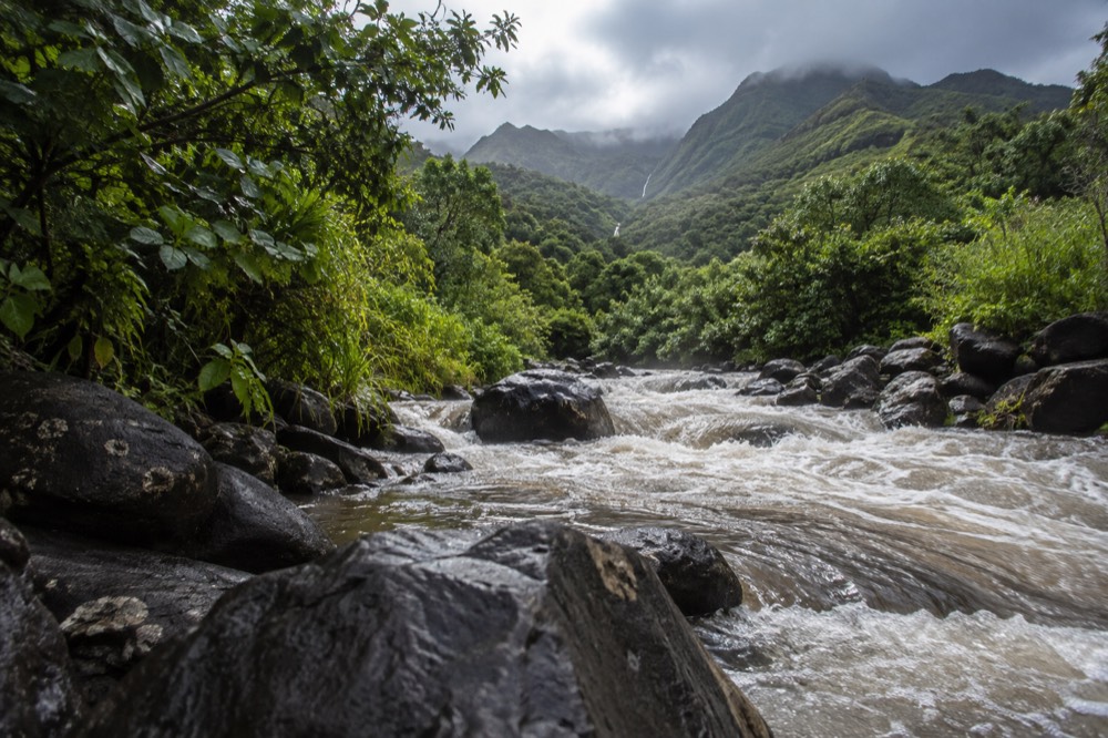
A flash flood is a rapid rise in water in a stream, gulch or low-lying area, typically within minutes to a few hours of the rain that causes it. On Oahu the classic pattern is a storm system dumping rain onto the Koʻolau or Waiʻanae mountains, where steep valleys concentrate runoff into narrow stream channels.
Because the valleys are short and steep, the water arrives downstream fast, sometimes before the rain that produced it has reached the coast at all.
The island's geology is the reason this happens so quickly. The Koʻolau range is the eroded remnant of a shield volcano, cut by deep, parallel valleys with almost no flood-plain storage. There is no wide, flat river bottom to absorb a surge. Water that falls as rain on the ridge is in the ocean within a short time, and everything in its path, including stream crossings, culverts, low bridges and the road itself, is in its path.
Two things make visitors especially exposed. First, Oahu's most popular walks are in exactly the valleys that flood: Mānoa Falls, like many waterfall trails, ends at the base of a channel that carries the whole valley's runoff. Second, the weather at your hotel is a poor guide to the weather in the valley. Waikīkī sits on the dry leeward coast, and the rain falls a few miles inland, so the mismatch between the sky you can see and the water coming down the mountain is the single most dangerous illusion on the island.
Why Does It Rain In The Valley But Not At The Beach?
Because Oahu's rainfall is extraordinarily localised. The official climate normals put Honolulu airport at 16.41 inches of rain a year, while the Lyon Arboretum in Mānoa, about five miles inland, records 150.96 inches, more than nine times as much. Every single month in Mānoa is wetter than the airport's wettest month.
A visitor checking the Waikīkī forecast is reading the weather for one of the driest spots on the island, not for the valley they are about to hike in.
This is the most useful piece of data on this page, and it comes from the NOAA 1991–2020 climate normals, not from folklore. The trade winds push moist air up the windward and mountain slopes, the air rises, the rain falls on the ridges, and the leeward coast, where nearly every visitor stays, sits in a rain shadow. The practical consequence: the forecast for Honolulu is the wrong forecast for Mānoa, Kāneʻohe, Nuʻuanu or any other valley destination.
| Station | Side of the island | Annual rainfall | Character |
|---|---|---|---|
| Honolulu International Airport | Leeward coast | 16.41 in | Driest; March wettest at 2.36 in, June driest at 0.50 in |
| Kāneʻohe Bay MCAS | Windward coast | 27.82 in | November wettest at 3.68 in |
| Mānoa, Lyon Arboretum | Windward valley, ~5 miles from Waikīkī | 150.96 in | Wettest month July at 15.35 in |
The direction of the rain matters as much as the amount. A kona storm, with winds swinging around from the south or west, can drench the normally dry leeward side and flood spots that residents think of as safe. Our Oahu rainy season guide covers when these systems are most likely, and the Oahu hurricane season guide covers the tropical-cyclone version of the same hazard.
When rain shuts down your valley plans, a guided island day is often the better use of the hours, since a professional driver reroutes around closures you would not hear about otherwise.
Which Oahu Spots Carry The Highest Flash Flood Risk?
Valley floors and stream crossings carry the most risk, and Oahu's best-known waterfall hikes all sit on one. The Mānoa Falls trail runs alongside and across the stream that drains the wettest valley on the island, and the same pattern applies to other popular valley walks: the destination is the waterfall, the waterfall is the stream channel, and the stream channel is the flood route.
Low road crossings in the same valleys are dangerous in a car, since a foot or two of moving water can push a vehicle off a crossing.
The list of high-attention places is short and consistent. Valley trails, especially any walk that finishes at a waterfall or follows a stream bed. Stream crossings of any depth, on any trail. Low bridges and ford crossings on valley roads. And the coastal plain where streams exit, which is where the water arrives after the rain has already stopped falling.
Two habits keep you out of most trouble. The first is checking the forecast for the valley, not the coast: the National Weather Service forecast for the Honolulu mountains is a different product from the beach forecast, and flash flood warnings are issued by zone. The second is treating any stream crossing as a decision point rather than a step. If the water is moving, discoloured or rising, the crossing is closed, whether or not anyone has put a sign up.
The self-guided Mānoa Falls product is a good example of how tours do not remove this risk, since self-guided means exactly that: the operator drops you at the trailhead, and the stream judgement is yours.
How Do You Know A Flash Flood Is Coming?
The warning signs are about the water and the sound, not the sky: a stream rising visibly, turning brown with sediment, carrying sticks and leaves, or getting louder, sometimes described as a freight-train rumble from upstream. Rain visible over the mountains while you stand in sunshine, or thunder echoing from the ridge, means the catchment above you may be getting water right now.
The National Weather Service issues a flash flood watch when flooding is possible and a warning when it is happening or imminent.
The order of the signs matters. By the time the water at your feet is brown and rising, the flood is already on its way down the valley, and your remaining move is to get to high ground fast, not to photograph it. The upstream signs, rain over the ridge, thunder from the mountains, a change in the sound of the stream, give you the minutes that matter. Local safety messaging repeats a phrase worth memorising: if you can hear the flood coming, you are already close enough to be in it.
| Signal | What it means | What to do |
|---|---|---|
| Rain or dark clouds over the ridge while the valley is dry | The catchment above you is receiving water | Reconsider the hike; watch the stream |
| Stream turns brown or carries sticks and leaves | Water from upstream is arriving | Leave the stream bed and crossings now |
| Stream rises visibly, even an inch or two | The flood pulse is starting | Move to high ground immediately |
| A rumbling or roaring sound from upstream | Debris surge approaching | Get to high ground immediately, do not cross |
| NWS flash flood warning issued for your zone | Flooding happening or imminent | Exit stream areas and low crossings |
One more habit worth building: know the zone you are standing in. A warning issued for the Honolulu mountains covers Mānoa, Nuʻuanu and the Koʻolau valleys, and it is easy to dismiss an alert that names a place you think you are not in. Check which zone your trail falls inside before you leave the hotel, while your phone has signal, because the deepest valleys are also the places where reception drops first.
What Should You Do If You Are Caught In Rising Water?
Do not cross, do not drive through it, and do not wait for it to go down. Move uphill, off the stream bed and away from the channel, even a few feet of elevation changes the outcome. If you are in a car, turn around before the water reaches the road: moving water only a foot or so deep can float or push a vehicle, and stalled cars in gulch crossings are the most common flash flood fatality scenario in Hawaii. If the water is already at your car doors, abandon the car and move uphill.
The physics is unforgiving and worth stating plainly. Moving water is heavy, roughly 62 pounds per cubic foot, and it pushes with a force that has nothing to do with how deep it looks. Six inches of fast water can knock an adult off their feet. A foot to a foot and a half can carry a car away. Depth is also deceptive: the road surface under brown floodwater may be gone entirely, washed out by the same surge you are trying to cross.
The after-the-flood rules matter too. Streams drop as fast as they rise once the rain stops, and the temptation is to finish the hike. But the trail itself may be undercut, stream crossings may have moved stones around, and the sediment cloud means you cannot see your footing. Rescue resources, if someone in your party needs help, are already stretched during a flood event. Give the valley an hour after the water clears before you trust a crossing again.
If you are on a trail and genuinely cut off, stay high and stay put. Rescuers in Hawaii repeatedly ask people not to attempt downstream escapes through flooded channels; a person waiting on high ground is a recoverable situation, while a person swept into a flooded gulch usually is not.
Which Oahu Sites Are Closed After Recent Storm Damage?
As of the DLNR notice dated 9 September 2026, three Oahu parks remain closed following Hurricane Lowell: Nuʻuanu Pali State Wayside (the Pali Lookout), Kaʻena Point State Park in its Mokuleʻia and Keawaʻula sections, and Wahiawā Freshwater State Recreation Area, all closed until further notice for storm repairs. Every other state park on Oahu had reopened by that notice.
Storm-related reservation refunds are issued automatically, minus non-refundable service charges, and take four to six weeks.
This list is a live situation, not a permanent fact. The closures above were confirmed from the DLNR State Parks notices in September 2026, and any page or plan naming the Pali Lookout or Kaʻena Point should be re-checked the week you travel, because "until further notice" can move in either direction. The general lesson from a hurricane season like this one is that storm damage lingers after the weather clears: a trail or lookout can stay closed for weeks after the sky is blue again, and flood-damaged stream crossings take longer still.
| Site | Status (DLNR notice, 9 Sept 2026) | Notes |
|---|---|---|
| Nuʻuanu Pali State Wayside | Closed until further notice | Storm repairs after Hurricane Lowell |
| Kaʻena Point State Park (Mokuleʻia and Keawaʻula sections) | Closed until further notice | Storm repairs; also a protected natural and cultural site |
| Wahiawā Freshwater State Recreation Area | Closed until further notice | Storm repairs |
| Other Oahu state parks | Reopened | Re-check before travel; situation is moving |
Storm seasons also reshuffle reservations. Hanauma Bay, Diamond Head and Pearl Harbor all run reservation systems, and a closure or weather cancellation interacts with them in ways visitors do not expect. Diamond Head requires a reservation for out-of-state visitors, booked up to 30 days ahead, and Hanauma Bay's reservation system opens two days ahead at 7 a.m. HST. If a storm closes a site on the day of your booking, the refund path is the operator or agency you booked through, and for state park reservations the DLNR process above applies.
How Do You Plan A Rainy Day On Oahu Around Flood Risk?
Plan by geography: on a wet day, put the leeward coast and the city on your itinerary and drop the valley hikes, because the dry side stays dry even when the mountains are being hammered. Check the mountain-zone forecast rather than the beach forecast, book activities that can move indoors or leeward, and keep one flexible afternoon rather than a rigid schedule.
A guided island tour is a practical fallback, since the driver reroutes around closures and weather in real time.
The leeward list is longer than people expect. Waikīkī itself, Ala Moana, downtown Honolulu and Chinatown, ʻIolani Palace, Pearl Harbor's museums, the Bishop Museum, Ko Olina and the whole dry southwestern coast all sit in the rain shadow that produces that 16-inch airport figure. A day that washes out Mānoa Falls is often a perfectly good day at Pearl Harbor. Our rainy day activities on Oahu guide works through the full list.
Timing helps too. Oahu's rainfall is not evenly spread through the day or the week, and mountain showers are often brief, passing pulses rather than all-day soakers. If the morning forecast shows showers over the Koʻolaus, the afternoon is frequently better, and vice versa. The one pattern not to gamble on is a kona storm or an approaching tropical system, which can rain on the dry side too and should move your whole day leeward or indoors.
For visitors who want the island overview without betting their one free day on the weather, the most-booked circle island tour is the straightforward answer: it covers the whole loop in a day, and the operator handles the rerouting.
The same logic applies to rainforest e-bike and valley products: check the operator's weather policy before you book, because a valley excursion on a warning day is a refund conversation at best.
If your dates are fixed and the forecast is uncertain, an attractions pass gives you a menu of leeward and indoor options to switch between without re-booking each one, which is exactly the flexibility a flood-risk day demands.
Common Questions About Oahu Flash Flood Safety
Most questions about flash floods on Oahu come down to three things: the rain falls in the mountains and not on the beach, the water moves faster than you can react to it, and the safe move is always high ground rather than a crossing.
Check the valley forecast rather than the Waikīkī one, treat any rising or browning stream as a closed road, and remember that the island's most popular waterfall hikes sit in exactly the valleys that flood. A warning for your zone means leave the stream now.
How fast do flash floods happen on Oahu?
Typically within minutes to a few hours of the rain that causes them. Oahu's valleys are short and steep, so runoff from the ridge reaches the coast quickly, and a stream can rise while the sky above you is still clear.
Can it flood in Mānoa while Waikīkī is dry?
Yes, and it is the normal pattern rather than the exception. The Lyon Arboretum in Mānoa records about 150.96 inches of rain a year against 16.41 inches at Honolulu airport, roughly five miles away, so the valley can be flooding while the beach is in full sun.
Is it safe to cross a stream if the water looks shallow?
No, not if it is moving, rising, or brown. Depth is deceptive under sediment, the road surface beneath may be washed out, and moving water only inches deep can knock an adult down. Turn around and wait; streams on Oahu drop almost as fast as they rise.
Can I drive through floodwater on an Oahu road?
Never. A foot to a foot and a half of moving water can push a car off a crossing, and stalled vehicles in flooded gulch crossings are the most common fatality scenario. Turn around before the water reaches the road, and if it reaches your doors, leave the car and move uphill.
Which Oahu hikes are most at risk of flash floods?
Valley and waterfall trails, because they follow the stream channel that drains the catchment. The Mānoa Falls trail is the best-known example. Check the mountain-zone forecast before any valley hike, and abandon the walk if the stream changes colour or level.
What is the difference between a flash flood watch and a warning?
A watch means conditions are possible; a warning means flooding is happening or imminent in the named zone. A warning for the Honolulu mountains covers the Koʻolau valleys including Mānoa and Nuʻuanu, and it means leave stream areas immediately.
The island will not always warn you politely. Respect the water when it moves, give the valleys a wide berth on the days they are working, and Oahu's streams will stay exactly what they should be on your trip: scenery, not a story you tell later.