Leeward Coast Oʻahu Guide: Beaches, Ko Olina And The Waiʻanae Side
Oʻahu’s leeward side includes the ʻEwa plain, Ko Olina and the Waiʻanae coast toward Mākaha and Keawaʻula. Choose a specific beach, boat departure or resort base, then plan the route, conditions and return journey.
Short answer
The leeward coast works as a planned west-side outing or a stay that matches your itinerary. Ko Olina lagoons, Waiʻanae boat departures and open-ocean beaches are different places with different conditions. There is no through-road around Kaʻena Point, and a standard circle-island tour is not a Waiʻanae coast tour.
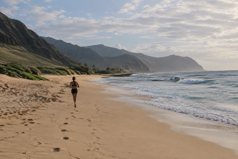
The leeward coast of Oʻahu is the side of the island most visitors never see, and the side residents of the Waiʻanae district would quite like to keep that way. It runs along the island's western flank from the ʻEwa plain, past the resort lagoons of Ko Olina, through Nānākuli and Waiʻanae and Mākaha, and ends at Keawaʻula, where the road stops and the Kaʻena Point trailhead begins. This Oahu Travel Guide page covers what the coast is actually like, what you can do there, and whether it should be your base or your day trip.
The starting point is geography. This is the generally drier leeward side, but weather and ocean conditions still vary. Ko Olina, Waiʻanae and the road’s end at Keawaʻula are separate destinations, and your actual itinerary determines the travel time. There is no road around Kaʻena Point to complete a coastal loop onto the North Shore.
Where Is The Leeward Coast Of Oʻahu?
The leeward coast is Oʻahu's western shoreline, running from the ʻEwa plain in the south to Keawaʻula and Kaʻena Point at the island's northwestern tip. Its main landmarks are Ko Olina Resort, the towns of Nānākuli, Waiʻanae and Mākaha, and Mākua Beach. Leeward means sheltered from the trade winds, which is why this coast is dramatically drier than the windward side around Kāneʻohe.
"Leeward" is a sailing term, not a marketing one. When the northeast trade winds blow, which is most of the year, they hit the windward coast first, climb the Koʻolau range, and drop their rain there. What comes over the top and down the western slopes is already dry. The result is a coast that looks almost desert-like in places: golden ridges, kiawe scrub, wide dry valleys. The Waiʻanae range, the older of the island's two volcanic massifs, sits closer to this coast than the Koʻolau does, and its highest ridges frame nearly every view.
The coast is not one place. The southern stretch around ʻEwa Beach and Kapolei is suburban, fast-growing, and anchored by the Ko Olina resort lagoons. The middle and northern stretch, from Nānākuli north, is the Waiʻanae district: small beach communities, a slower pace, and a resident population that carries real concerns about visitor pressure on two-lane roads and limited beach parking. Travelling there with patience and good manners is not optional courtesy, it is the difference between being welcome and being a problem.
What Are The Best Things To Do On The Leeward Coast?
The coast offers public beach time, Ko Olina’s lagoons and boat departures from Waiʻanae or Ko Olina Marina. Choose the exact place and current conditions rather than assuming all west-side water is calm. A boat trip, a resort stay and an independent coast drive are different ways to spend the day.
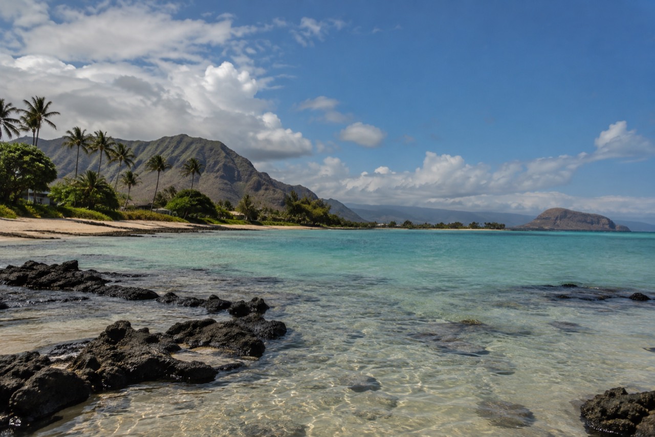
Ko Olina has four sheltered lagoons with public pedestrian access. Designated public parking is limited and first come, first served from sunrise to sunset. Hotel pools, chairs and other guest facilities are separate. There are no lagoon lifeguards, and rock barriers do not guarantee safe swimming for children or weak swimmers. Check conditions, follow signs and supervise children closely.
Northwest of Ko Olina, Waiʻanae is a working residential community. Plan around legal parking, local businesses and the beach you actually want to visit. Pōkaʻī Bay is sheltered by a breakwater, but conditions and designated swimming areas still matter. Waiʻanae Small Boat Harbor is the departure point for specific ocean excursions; use the operator’s exact dock rather than treating any beach or harbor entrance as check-in.
Mākaha, a few miles north, is famous in surfing history and still a serious surf break in season. Between November and April, when the west and northwest swells arrive, Mākaha can hold waves that demand respect, and swimming conditions change fast. In summer the same bay is often flat and pleasant. Check conditions on the day rather than trusting the season alone.
Check the exact approach before planning Kaʻena Point. The September 14 DLNR update reopened the Mokuleʻia vehicle road on the north side, while Keawaʻula remained partly open and its coastal trail closed. The two approaches are not connected by a coastal through-road. Kaʻena is a sacred place and protected wildlife area; follow access notices and posted restrictions. Our Kaʻena Point State Park guide covers the planning details.
Is The Leeward Coast A Good Place To Stay On Oʻahu?
A west-side stay can work when resort time or local outings are central to the trip. Ko Olina offers a resort setting; Kapolei offers a different city-hotel base. Compare the actual room and journeys before choosing either. A Honolulu-heavy itinerary or repeated cross-island outings may favor another location.
Ko Olina is a resort area around the lagoons, with large hotels and vacation ownership properties. At Marriott’s Ko Olina Beach Club, guestrooms and villas are different purchases; check the exact beds, occupancy and kitchen facilities. Compare the full stay total and planned outings with a Honolulu base. Pearl Harbor, downtown Honolulu and Waikiki are separate journeys eastward.
Accommodation farther along the Waiʻanae coast needs property-specific research, including lawful rental use, permitted stay and the actual location. Do not infer short-stay eligibility from a residential listing. Kapolei is another west-side hotel option, while Ko Olina is the resort choice described here. Our Waikīkī vs North Shore comparison covers other bases; compare your complete itinerary rather than treating one area as the only possible answer.
A generic circle-island tour is not a substitute for a Waiʻanae coast itinerary. The circle island day tour follows its own advertised stops; do not assume it visits Ko Olina, Mākaha or Keawaʻula. For a day on this coast, choose an actual west-side departure, an explicitly agreed private route or independent transport.
What Are The Beaches Like On The Waiʻanae Side?
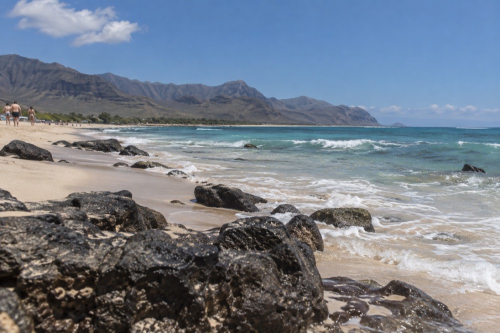
West-side beaches and lagoons differ in shelter, facilities and ocean exposure. Winter swells can be large, but hazardous surf and currents are possible outside winter too. Check current conditions and speak with lifeguards at a staffed beach before entering. Neither a season nor a sheltered appearance guarantees suitability.
Seasonal surf patterns help explain what you may see, but an old forecast cannot tell you whether a beach is suitable today. Use the current local forecast, warnings and conditions at the actual entry point. Ko Olina lagoons and an offshore snorkel stop are different environments, and each needs its own assessment.
A practical rundown of the main beach areas:
| Beach area | Character | Best for | Watch out for |
|---|---|---|---|
| Ko Olina lagoons | Four sheltered lagoons | Public beach time when conditions suit your group | No lifeguards; limited public parking and separate resort facilities |
| Pōkaʻī Bay, Waiʻanae | Bay sheltered by a breakwater | Beach time with current conditions and lifeguard advice | Use designated areas; boat tours have a separate exact harbor dock |
| Mākaha Beach | Surf beach with changing conditions | Shore-based viewing and beach time where suitable | Strong surf and currents can occur beyond winter |
| Mākua Beach | Long, remote-feeling stretch backed by valley | Quiet beach walks, scenery | Little shade, few facilities, long drive |
| Keawaʻula (Yokohama) | Beach at the road’s end | A visit only where current access permits | Partial opening and trail closure differ from the north-side approach |
Plan for the facilities and staffed areas at your actual destination. Do not assume every beach has lifeguards, reliable phone service or immediate assistance. For Hawaiian monk seals, NOAA recommends at least 50 feet of space, and 150 feet from mothers with pups; follow any larger posted buffer. Never approach, disturb or feed wildlife. These viewing distances are guidelines, while wildlife harassment is prohibited.
How Do You Get To The Leeward Coast Without A Car?
A car allows an independent coast itinerary, while TheBus serves west-side destinations and some specific activities offer transport. There is no rail station at Ko Olina or Waiʻanae. Skyline serves East Kapolei, the airport and Kalihi Transit Center; onward connections are required. Confirm the actual tour pickup rather than assuming all circle-island tours cover this coast.
TheBus fare structure is shared with Skyline: $3.25 for a single cash ride with no transfers, or a HOLO card at $3.00 for two hours of unlimited transfers, with a $7.50 daily cap. A 7-day pass is $45.00. Those numbers make a multi-stop transit day genuinely cheap, but the leeward coast's bus routes are commuter-oriented, and a day of beach-hopping Nānākuli to Mākaha by bus is a slow project. For a single destination, check the complete route, last leg, luggage needs and return service; a bus stop outside Ko Olina is not a lagoon or hotel entrance.
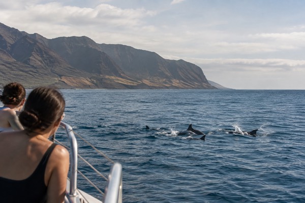
For a boat-based west-coast outing, Hawaii Nautical’s three-hour dolphin watch and snorkel sail departs from Waiʻanae Harbor Dock C. Gear, lunch and specified drinks are included. Select self-arrival or the paid Waikiki transport option and confirm the pickup. Dolphin viewing takes place from the boat; swimming with or approaching spinner dolphins within 50 yards is prohibited. A no-dolphin return-trip policy does not guarantee a sighting or a refund.
The Byodo-In circle-island tour is a different itinerary and should not be presented as a Waiʻanae coast tour. A trolley pass covers selected Honolulu lines, not a journey along this coast.
If you do drive, go early. Farrington Highway, the coast's main road, narrows to two lanes through the Waiʻanae district, and it carries commuter traffic, school runs and beach traffic on the same carriageway. Residents' driveways and shoulders are not overflow parking, and the highway patrol does enforce. Park in designated lots and build your day around them.
When Is The Best Time To Visit The Leeward Coast?
Choose your date around the actual beach, activity and current conditions. The leeward side is generally drier, but rain and storms still occur. Winter often brings larger west and northwest swells, while summer does not guarantee calm water. Sunset timing, access hours and your return journey all need to fit.
Climate averages from Honolulu airport or a mountain valley do not predict a particular Waiʻanae beach day. Check local weather and ocean conditions, and have an alternative when the planned activity or access is unsuitable.
| Planned outing | Check before setting the day |
|---|---|
| Public beach or lagoon | Conditions, posted access, parking hours and lifeguards |
| Boat excursion | Exact harbor, check-in, participants and selected transport |
| Sunset stop | Date-specific sunset time, legal access and return journey |
| Kaʻena approach | Current notice for that side and the specific road or trail |
A west-facing view can make a sunset stop appealing, but cloud and weather affect what you see. Check the date’s sunset time and park or parking hours, and plan a legal return route. Comfortable water temperature alone says nothing about safe ocean entry.
What Should You Know Before You Go To The Waiʻanae Coast?
Plan the actual route, legal parking and return journey, and treat the Waiʻanae district as a residential community. Facilities and staffed beaches vary. Check current Kaʻena access for the exact approach, and leave space for wildlife and residents’ daily use of the coast.
The practical checklist is short but every item matters. Bring water, cash for small food spots, and more sunscreen than you think you need, because the coast's dry air hides how strong the sun is. Fill the fuel tank before Farrington Highway thins out. Do not plan on finding restrooms or lifeguards at every beach; Ko Olina lagoons have no lifeguards, while staffed beach locations and operating hours must be checked separately.
The cultural footing matters here as much as the practical. The Waiʻanae coast has one of the island's largest Native Hawaiian communities, and Hawaiian, per the state constitution, is an official language of Hawaiʻi. Beaches where families have gathered for generations are not photo sets; monk seals resting on the sand are not a photo op at close range; and souvenir collection of shoreline sand, coral rubble or rocks is prohibited under state law, HRS §205A-44, which specifies limited exceptions. The "Pele's curse" story that circulates online is a modern invention, and the legal prohibition is the reason that actually counts.
If your trip also includes a separate Honolulu day, the trolley may help connect its selected city stops after you reach Honolulu independently. It does not collect visitors along the Waiʻanae coast or replace the journey from Ko Olina. Compare the actual lines with that city day before buying a pass.
Common Questions About The Leeward Coast Of Oʻahu
The main west-side decisions are the specific destination, transport and current conditions. Ko Olina resorts, public beach visits and Waiʻanae boat departures are distinct choices. Choose a base or day outing around your actual itinerary, without assuming a tour covers the whole coast.
Is the leeward coast worth visiting from Waikīkī?
Yes, as a day trip. The lagoons, open scenery and west-facing views can make a planned outing worthwhile. Choose stops that fit current conditions and the time available, allowing for the return journey. What it is not is a casual half-morning errand: the drive is long on a two-lane highway, so leave early and commit to the day.
What does "leeward" mean for Oʻahu?
Leeward means the side sheltered from the prevailing trade winds, which on Oʻahu is the west and southwest coast. The trade winds drop their rain on the windward side and the mountains, so the leeward coast is dramatically drier: local weather still varies, and a climate pattern cannot guarantee a dry or suitable beach day.
Can you swim at Ko Olina lagoons?
Public lagoon access is available, but there are no lifeguards and sheltered water is not a safety guarantee. Decide from current conditions and your group’s ability, supervise children and follow signs. Public parking is limited and first come, first served from sunrise to sunset.
Is Kaʻena Point open?
Access differs by approach. The September 14 DLNR update reopened the Mokuleʻia vehicle road, while Keawaʻula remained partly open and its coastal trail closed. Check the current notice for your exact road or trail. Respect the protected wildlife area and do not assume you can continue around the point by car.
Are there sharks or dangerous surf on the leeward coast?
Ocean hazards include changing surf, currents and marine life. Winter often brings larger swells, but other seasons can be hazardous too. Check current warnings and ask lifeguards at a staffed beach; when uncertain, stay out. A protected-looking bay or lagoon is not a guarantee of suitability.
Do you need a car for the leeward coast?
A car is the practical choice, but not the only one. TheBus serves the coast from Honolulu on shared fares with Skyline, a $7.50 HOLO daily cap makes a transit day cheap, and some specific boat trips offer a separately selected hotel transfer. A standard circle-island tour does not automatically cover Waiʻanae. What does not exist is a rail station at Ko Olina or Waiʻanae, so pure transit trips involve transfers and patience.
Plan a west-side visit around the actual places you want to see, whether that means a Ko Olina resort stay or a day from Waikīkī. Compare the coast with other things to do in Oahu, allow time for the return journey, park legally and leave the beach as you found it.
Plan Your Leeward Coast Journey
Start with independent driving, or switch to a Waiʻanae boat trip, Ko Olina stay, marina cruise or airport transfer. These are separate services with different locations.
Compare Honolulu Airport Rentals
Confirm HNL pickup, license, deposit and complete rental/parking cost. There is no coastal through-road around Kaʻena.
Check the supplier’s age, licence, payment-card, deposit and pickup conditions. Quote totals and branch hours depend on your dates.
Compare Complete Transport Costs
Enter USD estimates for the same party, dates and set of journeys. Rental quote includes taxes and mandatory fees; add only unbundled fuel, parking and extras. Compare with the complete public/hired transport alternative. Activity tickets and hotel costs are separate. These are your estimates, not live quotes.
Choose your dates, pickup and driver details on EconomyBookings. This link opens a rental search, not live results on this page.